|
ACTIVITIES AND EXPERIENCES IN EL NIDO 島上活動

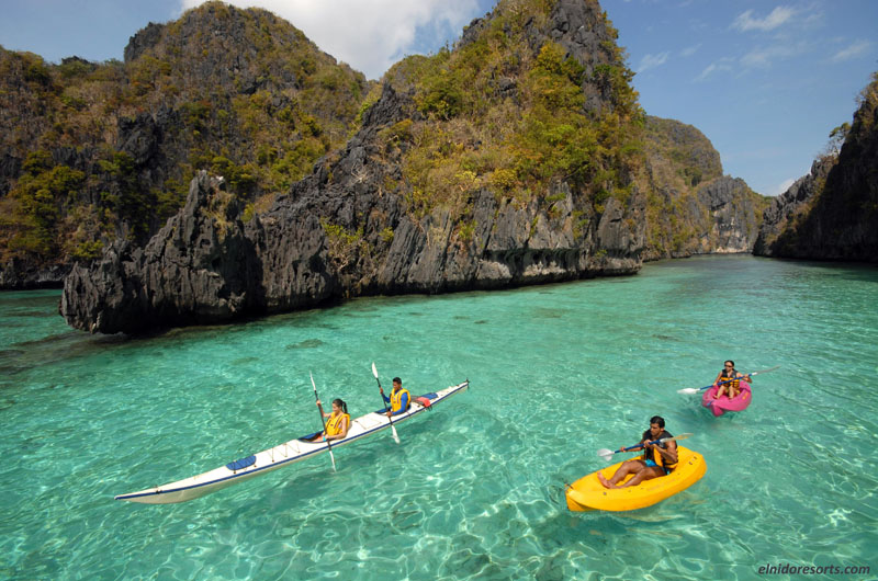
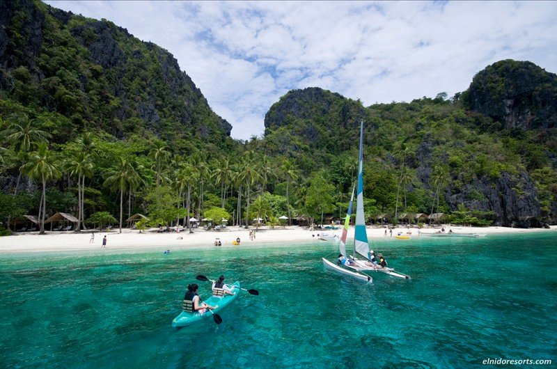
SPORT AND OTHER FUN ACTIVITIES
 |
Badminton |
|
|
Beach Volleyball |
|
|
Billards |
|
|
Darts |
|
|
Frisbee Games |
|
|
Group Board Games |
|
|
Table Tennis |
|
|
Treasure Hunting |
|
|
Parties |
|
|
Coconut Hat Making |
ATTRACTIONS AND PLACES OF INTEREST IN EL NIDO
DIVING AROUND BUSUANGA 潛水資訊
| |
| |
IRAKO |
 |
 |
A Japanese Refrigeration Ship, 147 m. long & 9,570 tons
displacement, Location: At the mouth of Coron Bay Probably the best wreck dive
in the Philippines. The Irako is quite intact and because of the good visibility
you know you are on a big shipwreck. Big groupers, schools of tuna and yellow
fin, lion fish and scorpion fish live around this wreck. Two sea turtles live in
the crumpled and folded metal of the superstructure. There is a beautiful deep
penetration through the engine room for trained, experienced and properly
equipped divers.
The Irako Maru usually has the best visibility of all the
wrecks in Coron Bay. |
|
|
|
This dive is best made at deck level while breathing 32% Nitrox for a 50% increase in allowable bottom time.
Penetration of the interior would require 30% or 28% Nitrox depending on which deck level you wish to swim through. Max depth: 43 meters on the bottom, deck
level at 28 to 35 meters. Recommended certification level: Advanced Open Water Diver, Deep Diver Specialty, Wreck Diver Specialty. |
| |
| |
|
AKITSUSHIMA |
 |
 |
The AKITSUSHIMA was Japanese Seaplane Tender, 150 m long. Gross Tonnage: 4,650 Location: Between Culion & Busuanga
Islands, near Manglet Island. The Akitsushima is a very big warship that lies on her port side. She was hit near the stern where the flying boat
rested on the metal tracks and sank immediately. The ship was almost torn into two pieces. The flying boat disappeared. |
|
|
Only half of the metal on
the starboard side and half of the metal on the bottom of the ship kept the stern from separating from the rest of the ship. The internal damage is
impressive. The crane used for lifting the seaplane out of the water is intact. The crane is lying on the sandy bottom and attracts schools of giant batfish and
barracudas. One mounting of a 3-barreled AA (antiaircraft) gun is still present at the front of the flying boat tracks. This is a fascinating dive where you can
see giant groupers, schools of barracuda hiding under the bow, and yellow fin tuna. Due to depth and metal hazards within, no swim-through's
are allowed without wreck diver certification. Wreck divers can make an impressive penetration into the engine room to see the four engines.
This dive is best made while breathing 31% or 32% Nitrox
for a 50% increase in allowable bottom time. Max depth: 36 or 38 meters, average depth about 26 to 28 meters. Recommended certification level: Advanced Open
water Diver. For penetration: PADI Wreck Diver specialty. |
|
|
| |
| |
KOGYO MARU |
 |
 |
A Japanese freighter carrying construction materials for building a runway for the Japanese war effort in the Pacific. Kogyo Maru was built in 1938
and is 158 m long with a displacement of 6,353 tons. Lying on her starboard side in 36 meters of water, the Kogyo Maru offers swim
through's into all six holds and through the engine room and bridge area. |
| |
Kogyo Maru's second hold contains an incline of cement bags
which tumbled as the ship sank. A small bulldozer draws your attention as you
swim into the hold. Complete but encrusted, you can imagine the operator sitting
in the seat and working the control levers to carve a runway out of a tropical
island. Engrossed in the bulldozer you might fail to look up the incline of
cement sacks and so miss the tractor and air compressor perched above it. Take
the time to swim up and look at both pieces and see how many of the engine parts
you can identify. It's complete. Check out the metal wheels on the tractor.
Coming out of the hold swim up the front mast, now
horizontal, and on your left side. At the top of the mast look at the crow's
nest and imagine what a lookout would experience when perched 30 meters above
the water in Japanese winter storm. Swim back over the deck to the bridge and
engine room below it. Enter both from the stern side for easier access. Swim
through the cavernous engine room and look at the hardware then out through the
bridge. If air is low go up to the port side of the bridge and look at the soft
corals growing there and the fish life living on this artificial coral reef at
22 meters. If you have enough air continue below deck level to the stern looking
at all of the deck hardware for moving cargo and working the ship. Pass around
the stern and then go forward over the port side to return to the mooring line.
You pass over hard and soft corals covering the side of the ship. On this dive
keep your head and eyes moving like a fighter pilot's to see the school of
barracuda which will swim by. If you only look at the Kogyo Maru you will miss
the barracuda.
This dive is best when made while
breathing 31% or 32% Nitrox for a 50% increase in allowable bottom time. If you
dive the Kogyo Maru with a 100 cubic foot tank of Nitrox 32 you have enough gas
mixture and a long enough No Decompression Limit to cover the whole ship on one
dive. Max depth: 34 m, average 24-26m Recommended certification level: Advanced
Open Water Diver, Wreck Diver Specialty. |
| |
| |
| OKIKAWA MARU |
|
 |
 |
The OKIKAWA MARU was an Oil Tanker of the Imperial Japanese Navy, 160 m long. Location: Busuanga Island, 2 miles south of Conception. In length, width, and volume the largest of the Coron wrecks. At this depth you may be able to make an hour-long dive. If the Irako isn't the best wreck dive in the Philippines then the Okikawa Maru certainly is! This wreck is totally covered with beautiful corals and offers a large variety of marine-life. The deck is between 10m and 16m and is good for wreck dive beginners.
|
| |
There are many penetration possibilities for advanced wreck divers including penetrating up the propeller shaft from the outside of the ship all the way into the engine room. Strong tidal currents often affect this wreck. Diving in strong currents lets you see the most fish. At the bow you can see the resident three legged turtle and a school of snappers holding position into a slight current. Large fish shelter out of the current behind crumpled metal and inside of the deck houses .There is also a large resident grouper near the bottom.
This dive is best when made while breathing 36% or 38% Nitrox for a 75% increase in allowable bottom time. Dives in excess of one hour are common on the Okikawa Maru. Max depth: 26 meters on the bottom, 10 to 16 meters on the deck.
Recommended certification level: (1)
Diving outside the deck without current a current. Open Water Diver. (2) Diving
with a current. Advanced Open Water Diver. (3) Diving with a strong current.
Experienced Advance Open Water Diver. (4) Penetration Dive. Wreck Diver Specialty. |
| |
| |
| OLYMPIA MARU |
|
 |
 |
A Japanese Freighter sitting upright with a length of 122 meters. Location: Coron Bay . A very good dive spot with a variety of marine life. Large shoals of banana fish, giant bat fish and giant puffer fish, especially around the mast, bow and stern. Easy penetration at the cargo rooms. It offers a good opportunity to discover wreck diving. |
| |
This dive is best when made while breathing 36% Nitrox for a 75% increase in allowable bottom time.
Max depth: 28-30 meters, deck level 18-24 meters.
Recommended certification level: Advanced Open Water Diver, Wreck Diver Specialty. |
| |
| |
| KYOKUZAN MARU |
|
 |
 |
A Japanese freighter approximately 160-180 meters long.
Location: Northeast of Busuanga Island. Due to it's distance from Coron, this wreck is dived by a one hour jeepney ride to the north end of Busuanga and transferring to a rented dive boat. This is done as an all-day trip for two dives on the Kyokuzan Maru. |
| |
This is a beautiful wreck dive experience. More or less intact, this huge sunken ship usually offers good visibility of about 20 meters and ideal diving conditions. Japanese staff cars and trucks can be found in the cargo rooms.
This dive is best when made while breathing 36% Nitrox for a 75% increase in allowable bottom time. Max depth: 40 meters on the bottom. The deck level lies between 22 and 28 meters. |
| |
| Recommended certification level: Advanced Open Water Diver, Wreck Diver Specialty, Deep Diver Specialty. |
| |
| TANGAT WRECK |
 |
Another Japanese freighter approximately 122 metres or 400 feet long, 5000 gross tonnage.
Location: West of the southwest end of Tangat Island.
Access: 1 hour west by boat.
Conditions: Normally calm, with light currents that can become very strong at spring tides.
Visibility: 25 to 50 feet.
Average Depth: 24 metres or 80 feet.
Maximum Depth: 30 metres or 100 feet. |
The Hektor (Tangat Wreck) was sunk on 24 September 1944 by US aircraft. It sits almost upright with perhaps a 15 degrees list to port, pointing 170 degrees (compass bearing) in 100 ft of water; the main deck is at 60-80 ft. The site provides a good introduction to wreck diving for novices, with easy penetration of the cargo holds and a good variety of fish life. There are several large puffer fish, lots of large lionfish and scorpion fish, a lone bumper head parrotfish, schools of batfish, snappers and sweepers, six-ban dad angelfish and innumerable sponges. In good visibility this is an excellent wreck for photographers. |
| |
| |
| TIRUKAZE MARU |
 |
Submarine Hunter and tugboat of the Imperial Japanese Navy combined fleet. 40 metres or 131 feet long, 3-19m depth, 4650 gross tonnage.
Position: N 11*58. 447’, E 120*04.744’
Sunk on September 24, 1944.
Location: Inclined on the coral reef on the east side of Tangat Island.
Dive Site is good for wreck diving beginners and underwater photographers.
|
It is also a lovely dive between deeper wreck sites. The wreck starts at only 3 meters down so even snorkelers can see the shape and explore the bow of the ship. This dive is best when made while breathing 36% or 38% Nitrox for a 75% increase in allowable bottom time. Max depth: 22 metres / length: 20 metres. Recommended certification level: Skin Diver, Open Water Diver. |
| |
|
 |
| LUSONG GUNBOAT |
 |
A Tugboat converted to a Gunboat for the Japanese Navy Fleet.
35 metres or 114 feet long.
The stern breaks the surface at low tide.
Location: In front of the East Side of Lusong Island.
Position: N 11*58. 260', E 120*01.447'
The Maximum Depth is 11 metres.
|
This wreck is great for snorkeling and is next to a wonderful reef whose depth ranges from 3 & 18m. It is good as a "dive between
dives". A heaven for wreck diving photographers and suitable for inexperienced divers. Recommended certification level: Skin Diver, Open Water Diver. |
| |
| |
| SKELETON WRECK |
 |
A Fishing Boat 25 metres long. So named Skeleton because what you see in this wreck is the keel, ribs, and stringers of a steel-hulled
boat.
Location: Northwest corner of Coron Island.
|
|
This wreck was beached with the bow a dozen meters from Coron Island. The stern points directly away from the island. The wreck slopes along the reef from 5 meters deep at the bow to 22 meters at the stern. A pass through on the starboard side of the hull at 14 meters allows you to swim from the inside of the boat out over the coral reef. Max depth: 22 meters on the bottom. Slopes from 7 to 22 meters.
Recommended certification level: Skin Diver, Open Water Diver. |
| |
| |
| BLACK ISLAND WRECK |
 |
The Black Island Wreck is actually a small converted tanker designed to carry fuels that were from the Japanese Imperial Army.
Location: The East Side of Malajon Island, Busuanga, Palawan
Access to dive site: 3-5 hours by boat.
Main Attraction: Wreck Diving, Snorkeling
Minimum Depth: 12 metres or 40 feet
Maximum Depth: 34 metres or 110 feet
Conditions: Medium currents; rough with fierce currents
during bad weather.
|
|
The wreck is just off the beach, in front of a stranded
vessel on the shore. Its marine life includes large scorpion fish, lion fish, and many more varieties of small to huge fishes such as schools of bat fish, sweepers and trumpet fish. Here you can also see angelfish (emperor and six-banded), sponges, hydroids and crinoids.
The wrecks’ minimum depth is at about 12 meters but actually starts to be visible at 20 meters. This place is also famous for undersea photography and also night diving.
Recommended certification level: Advanced Open Water Diver, Wreck Diver Specialty. |
| |
| |
| BARRACUDA LAKE |
 |
The Barracuda Lake, is an 'interesting and unusual dive'.
There will be few other places in the world that would be as spectacular and
mesmerizing as the Barracuda Lake.
Location: Coron Island, Palawan
Main attraction: Diving, Snorkeling, Underwater Photography
Getting there: 15-20 minutes by mountain climbing.
Depth: 33-40 metres+
Visibility: Dark and Murky
Conditions: Weak Currents
Best months: Year-Round
|
|
The dive starts with a challenging mountain climb over sharp
limestone cliffs in full diving gear for 15-20 minutes until you reach the lake. As
you approach the Lake you will be floored by the scenic beauty of the
surroundings. Then there's a 33m dive to a cave with 30m of penetration. The
cave is situated on the north wall of the lake so named for its resident
barracuda who may deign to show you around. Barracuda lake is a reverse thermal
lake, water temperature at surface, is 28 degrees°C. The temperature stays
constant to aprox 14m at which point a very visible thermocline separates
the "cool" upper water from the 40 degree°C water below. Underwater photography would be
excellent at this point. Recommended certification level: Open Water Diver, Mountain Climbing Diver Specialty. |
| |
| |
| KAYANGAN LAKE |
 |
Considered as the "cleanest freshwater lake" in the Philippines.
Location: 30.4m inland from the centre of the northwest face of Coron Island.
Main attraction: Diving, Snorkeling, Underwater Photography
Getting there: 45 mins. south-southeast by boat to a cove between Limaa Point & Balolo Point northwest face of Coron Island.
Maximum Depth: 40 metres+
Visibility: hazy 30m near surface, varies w/ mixing of hot & cold water.
Conditions: Calm Lake surrounded by high walls, sheltered on all sides.
|
|
Kayangan lake is one of the divers' favourites among the
many lakes in Coron Island. The stunning picture perfect view of the lake will
be seen after a brief walk up a mountain trail. The lake is surrounded by steep
limestone cliffs. In the centre of the cove the cliffs have a gap at sea-level.
You climb through this gap for 3m. turn right and climb easily over sharp
limestone pinnacles for 7m. in full diving gear for a few minutes, traverse to
the right 4m. then turn to the left to descend continuing across two small
channels to the entrance of the lake.
This is a unique dive. The
turquoise freshwater lake, surrounded by spectacular limestone cliffs, is served
by a hot spring. As you move out from the walls and descend, the water gets
hotter and hotter. At 30m, temperature is 40 degrees °C and deeper down would
even be higher. There is little to see in the very hot water, but when you get
back to the walls of the lake, a lone habituated barracuda, nearly 1m long will
be waiting to be hand-fed.
There is clearly interaction between salt & fresh water
around the seaward side, as you can find seawater species there. As well as the
barracuda, there is a shoal of golden rabbitfish, snappers, catfish, some
species of shrimp and shellfish. |
| |
| |
| CATHEDRAL CAVE |
 |
A cave under Coron Island, directly connected to the sea.
Location: South end of Coron Island on the East side.
Main attraction: Diving, Snorkeling, Underwater Photography
Maximum Depth: 10 metres inside the cave.
Visibility: 20-30 metres into the open sea.
Weather Advisory: Cathedral Cave CAN ONLY BE ATTEMPTED in
calm weather with slight waves. It is physically dangerous to attempt to enter the tunnel in the surge generated from large waves.
|
|
Cathedral Cave is a beautiful dive spot. It starts 6 metres
deep at a hole in the bottom of the sea next to the sheer rock wall of Coron
Island. You enter a tunnel and descend to 12 metres. If you take the time to
look, you'll see the antenna of juvenile lobsters waving from holes in the tunnel
above and out from under the rocks below and cowry shells clinging to the
ceiling of the tunnel.
Then you pass out of the tunnel and sea a shaft of daylight
penetrating the interior of the cave. The roof of the cave has collapsed sending
down a full sized tree. The skeletal trunk and main branches of the tree rest on
top of the sand mound in the middle of the cave. You follow the light and
surface inside a big underground cathedral. You pass over the sand dune and
continue ahead and left to another passage that leads to a chamber with an air
pocket above ocean level. Back through the tunnel into the open sea and you dive
among beautiful corals with 20 to 30 metres visibility.
Recommended certification level: Advanced Open Water Diver,
Cavern Diver Specialty. |
| |
| |
| APO REEF |
 |
The "world's 2nd largest contiguous coral reef" & the largest in the
Philippines.
Location:
33 km west of the Midwestern coast of Mindoro Island.
Access: 3 hrs by boat from Busuanga, Palawan.
Main attraction: Diving, Snorkeling, Underwater Photography.
|
|
The Apo Reef Natural Park consists of three islands, namely
Apo Island, Apo Menor (Binangaan Island), and Cayos del Bajo. Apo reef is the
largest among the three. It has an area of 15,792 hectares including land and
water areas. It was declared a protected area in 1996. Apo Reef has a unique
natural phenomenon with a high diversity of corals and has an island covered
with terrestrial vegetation.
The Apo Reef, with more than 20 dive sites is a wonderful
site for snorkeling and scuba diving, its crystal blue waters cover coral reefs
teeming with mantas, tropical fish and morays, including the endangered Green
Sea and Hawksbill turtles as well as 500 species of soft and branching types of
hard corals. It also hosts 47 species of migratory and resident birds. The reef
is famous for its steep walls down to 30-80 metres which are well covered with
corals, sponges, tunicates, nudibranchs and slugs. The reef
plateau is magnificent which will surely impress divers and snorkelers alike.
Recommended certification level: Advanced Open Water Diver. |
| |
|
